Tibet from Above: Unveiling Himalayan Monasteries through Spy Plane Images
Tibet from Above locates, analyzes, and documents Buddhist and Bonpo monasteries and other architectural monuments that were damaged or destroyed during the occupation of Tibet and the Cultural Revolution. It offers unprecedented insight into the architectural landscape of Tibet during a pivotal era of the region's history, expanding on our ongoing project, Temples of Tibet. We are grateful for the expertise of our collaborators, scholar of heritage studies Dr. Karl Ryavec and U-2 image expert Lin Xu.
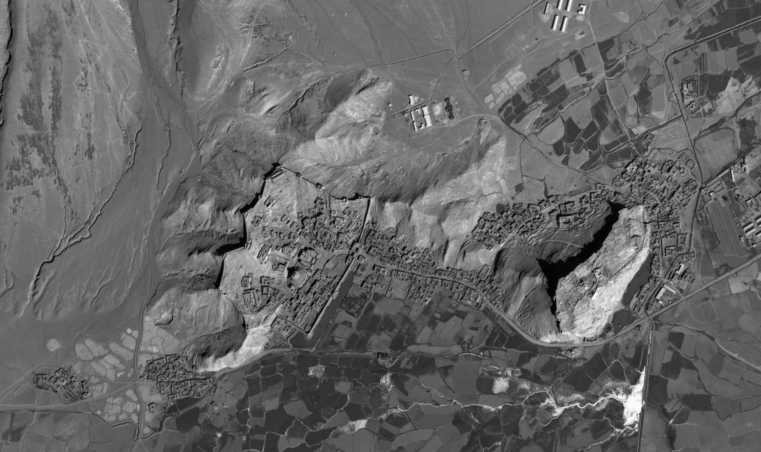
The research relies on largely uninvestigated air photos taken by US government U-2 spy planes based in South and Central Asia during the Cold War. These photos were declassified in 1997 and are currently stored at the US National Archives and Records Administration. The images capture Tibet’s built landscape at an incredible ground resolution of approximately 1 to 2 feet, offering crucial pictures of structures that had never been photographed and were destroyed shortly after. Tibet from Above’s methodology highlights the potential for future computationally supported analyses of Tibetan architecture and of changes in the built environment as both indicators and subjects of geo-political change.
This project is a 2024-25 recipient of the Rubin x Research Grant by the Rubin Museum of Himalayan Art, which generously supported research travel along with this digital exhibition and open-source database. We welcome all comments, attributions, and related stories at info@nyandak.com.
This interactive map geolocates U2 aerial images of monasteries across the Tibetan plateau. The satellite base map indicates the current state of these sites and the scale of historical destruction of the Cultural Revolution. These aerial images have been orthorectified, with their original form available for high-resolution download. The map also contains verified locations of other historical temples, which are sites of potential further investigation explored in our project Temples of Tibet.
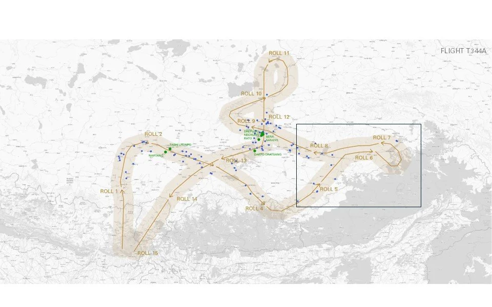
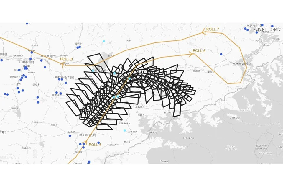
Geolocating image frames from a U2 mission is a long and complex process. A single flight mission contains approximately 10 rolls of film (Image 1). After identifying the roll of film that might contain information of interest, the image frames are laid out on the flight path (Image 2). This further allows us to ascertain precisely which image might contain a photograph of a cultural site. Often, the accompanying mission report - which contains information on the speed and distance of travel - is a useful supporting source to corroborate the flight path and the corresponding images generated. These images, all taken at an angle, must be orthorectified before they are used as an evidentiary source (Image 3).
